A 325 km Bicycle Ride across South
Florida
from
Ever since I moved back
from
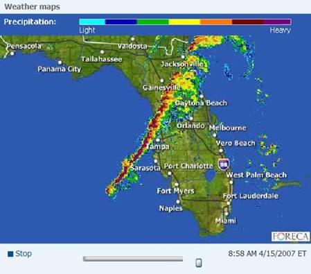
Sunday, April 15, was just
such a day: There was an intense cold front moving across
After
finishing my taxes at home during the morning of this rainy Sunday I decided to
go for the
The
usual preparations kick into effect: Notifying the folks at work about taking
the day off, researching the proper mode of transportation (here Greyhound
bus), packing the bicycle in a card-board box (“procured” from the dumpster of
the local bike shop), preparing backpack and – most importantly – getting into
the right frame of mind (as well as a good dinner the evening before). All
seemed familiar, if only a bit rusty, as I hadn’t done a long tailwind ride in
2 ½ years…
Using
my Mappoint software, I came up with the following specific route: From
Clermont (1) (about 30 km West of Orlando) down South, passing Haines City (2),
following Hwy 27 in the middle of the State down to Sebring (3), then more
South-East towards Okeechobee (4), along the very nice Lake Okeechobee
Scenic Trail on the levee to Port Mayaca (5) and finally following
the St. Lucie Canal cutting across from to the Atlantic Coast in Palm Beach Gardens
(6).

At
least some part of this ride (the last third) I had done before; for example,
check the trip
report from circum-navigating
Monday, April 16,
2007
The
Greyhound bus leaves
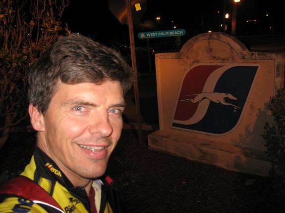
After
an uneventful drive with no comfort and no real sleep it feels way to soon when
we arrive in

It
is still dark outside and people here complain about the unusual cold weather –
it is around 50 F (10 C) and probably the last cold spell like this until next
fall / winter. I ask to be dropped off at the nearest gasstation to the Hwy 27
intersection, since I will need light to re-assemble my bike.

I
finally get on the bike and on my way at around 6:30am, roughly ½ hr prior to
sunrise. There are plenty of rolling hills in this area, and the night sky is
starting to glow with the huw of another day.

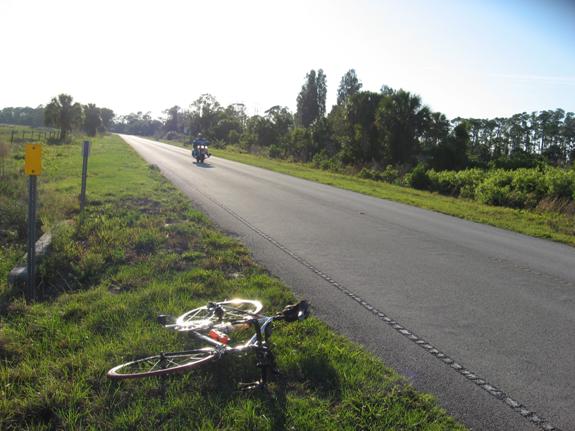
Already
plenty of traffic – after all this is a workday – I’m glad to have purchased
another blinker for my bike to remain visible in the dark. I am full of
anticipation for the next 12 hours or so. Will the traffic be manageable? The
road free of construction? The bike without flat tire or other problems? I
guess I will find out…
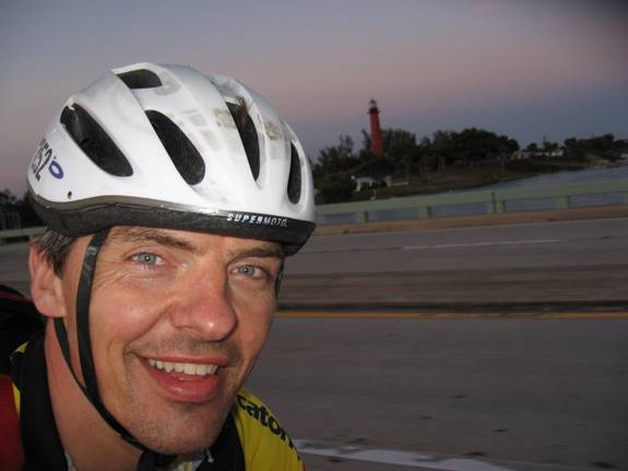
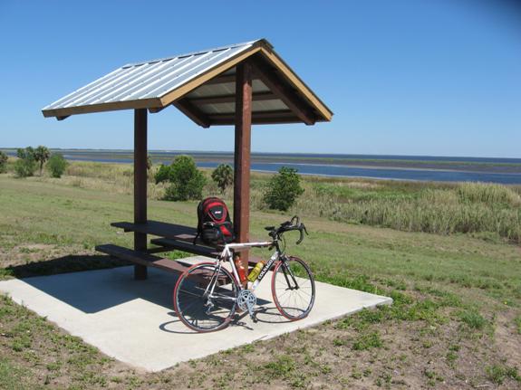
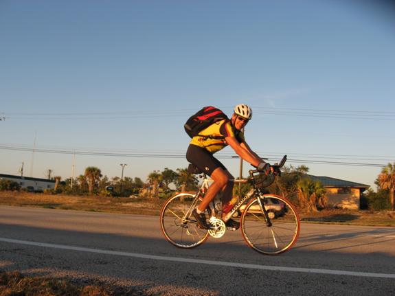
The
sun comes up just after 7:00am and prompts me to stop to take a picture:

(Colnago
and Gatorade should sponsor me for all these commercials!)
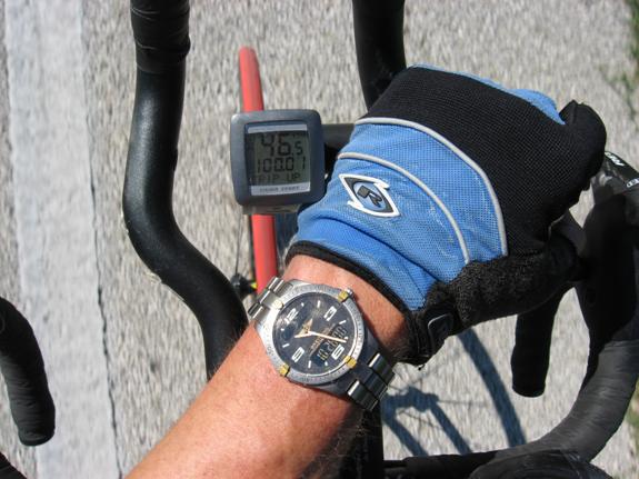
I’m
riding in full clothing as it is definitely cool, if not cold. I remember
pulling the long sleeves over my wrist-watch, as it’s metal wrist-band makes it
feel very cold against my skin.
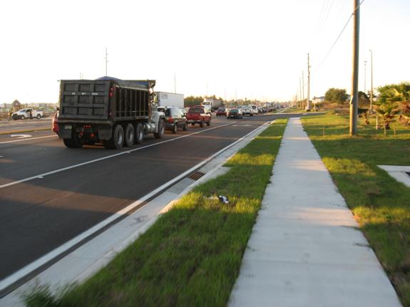
Here
is also the worst part of the entire ride, as it is rush-hour and we’re getting
close to the I-4 Interstate highway. On this particular stretch a dedicated
side-walk substitutes for the shoulder or bike lane, and it is prudent to use
the side-walk with this much traffic. I hope traffic will subside quickly once
I get South of I-4.
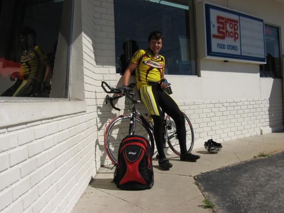
Once
I reach the I-4 overpass I stop for breakfast in a local Denny’s. Just prior to
rolling into their parking lot there is a bit of a scare for me when I hear a
loud “Twang” from my back wheel, followed by a noticeable wobble in the wheel.
For a second I’m very concerned that some of the spokes may have broken and
that perhaps I wouldn’t be able to continue this ride. But luckily, I can fix
the wobble quickly thanks to the tools I always carry with me and no spokes are
broken.

After
a breakfast of coffee and a banana muffin I feel better, freshly caffeinated.
The intense sun is warming up so I can continue without the long-sleeved
jersey, and the tailwind is increasing in strength. For more than 2 hrs I
hardly take any pictures. At times, the tailwind helps me to push my speed
upwards of 25 mph (40 km/h), which helps me to get back to my average rate of
100 km for every 4 hrs of elapsed time (including stops).
The
day is young, the sky is blue, the wind is intensifying to about 15 mph (25
km/h), my speed climbs, traffic subsides and all is good. I am reminded again
of why I do these rides: At times
like these I am in flow.

I
stop at the next gasstation since my bottles are near empty and I need to give
my butt some rest. I also can shed the long pants now – and need to apply
sunscreen generously, as the 13 hrs of sunshine today require adequate skin
protection.
The
air on the backside of the cold-front is extremely dry, which means there is
not a cloud in the sky today. It also creates excellent visibility, which will
later be especially noticeable on the shores of
After
another 45 mins or so I reach the lake near Sebring at 125 km (78 miles). The
wind is strong, but its direction worries me a bit as it is more North, almost
North-East (rather than the forecast North-West). This could become a problem
on my next leg from Sebring to Okeechobee, which follows a South-East
direction. For now, I’m sitting at the shore of the little lake in Sebring and
look out over the water with white caps.
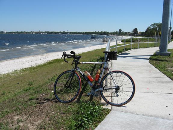
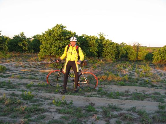
From
here I send a quick status update from my BlackBerry to
Just
South of Sebring I leave Hwy 27 and turn left to follow Hwy 98 on a more
Easterly heading towards Okeechobee. The road passes Sebring’s well-known
Racetrack, but I don’t have the time or energy for detours. I do take the time,
however, for the occasional picture capturing the more rural character of
central

This
road is less travelled than Hwy 27. There is not much happening on the road,
with at times very long straight-aways, plenty of time to reflect upon the ride
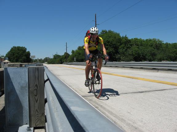
and the entire experience. I take time to setup a self-timed picture while
crossing a bridge over a small canal.
I
also start “reflecting” more and more about the physical discomfort which
starts to seep into the experience – something I tend to forget and write less
about after the fact. But during the ride it can actually get quite
frustrating, the desire to just stop pedaling and call it quits, coupled with
the knowledge that only the bike will take you far enough and quick enough to
reach the planned destination by end of day…
So
you shift your position on the bike, get out of the saddle and coast for a
little bit, then resume the monotony of pedaling, while watching the scenery
and counting down the miles.
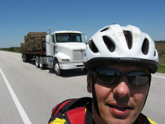
I
also take several pictures of the passing trucks to break the monotony of a 10+
mile straight-away!
Shortly
after 1:00pm I stop to relax in the shade of a tree. Thankfully the air is
fresh and crisp, almost a bit chilly in the shade with the breeze.

Like
so often in the past, mentally I start to break up a very long distance into
smaller segments. Each of those is easier to handle. So in this case I look at
my next goal of reaching Okeechobee at a bit over 200 km (120 miles). One of
the other intermediate goals is to negotiate a short segment after crossing the
Turns
out though that the bend is shorter than the Mappoint map made it look - I had anticipated a struggle far worse and
longer than the actual effort for this section of the road. To the left and
right of the road there are many more signs of the rural environment here just
North of the big lake.

I’m
thinking, what a difference to the
I
finally get to Okeechobee at about 2:30pm, still by and large on schedule with
now about 8 hrs elapsed time for 200 km.
I
actually stop just 1 mile short of this picture to buy more water and food,
since I know that the following course along the levee trail and further East
of the lake does not feature any gasstations or reststops. Hence I load up on
two fresh bottles on the bike plus one extra in the backpack.
Unfortunately
I seem to have broken the lense cover of my Canon PowerShot camera during this
last stop, so I have to manually open the lens cover and keep it that way to
allow for ongoing pictures to work.
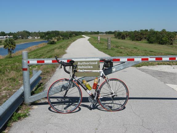
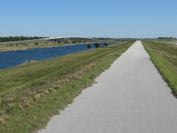
Soon
thereafter I reach the Northern tip of the lake and ride up to the levee. I
stop at a little pavillion which I recall from my last ride around
the Lake in 2005.
From
here I send a second email update and also call my dad in
After
eating, drinking and applying more sunscreen the ride continues. The following
22 miles (35 km) or so are some of the most scenic miles anywhere in
Not
only do you see half of the lake due to the high vantage point on the top of
the levee and due to spectacular visibility of the dry, fresh air today…
…
but also do you see the occasional wildlife, like for instance the big
alligators soaking up the heat of the sun on the sandy beach.
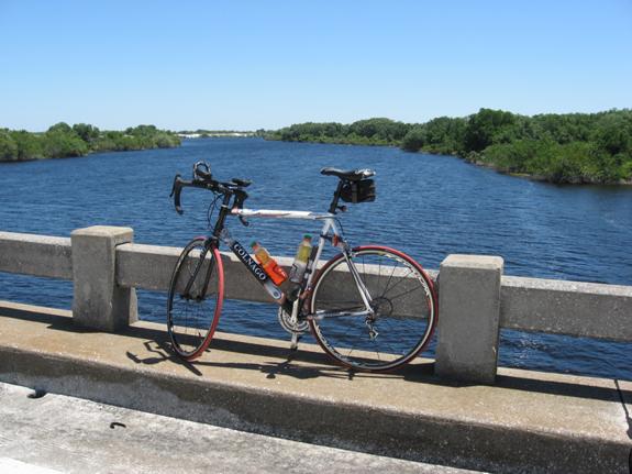
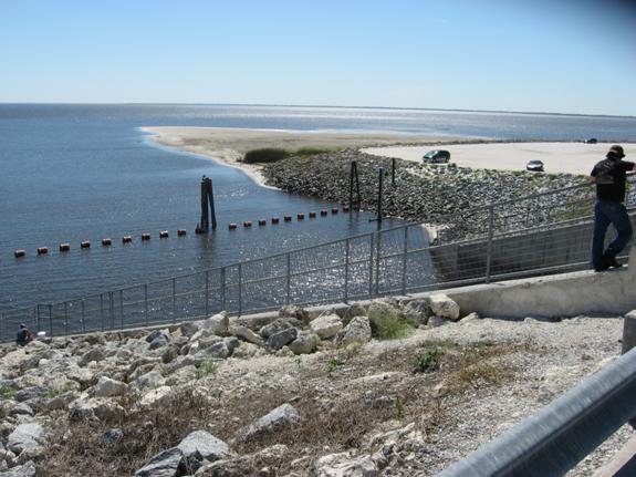
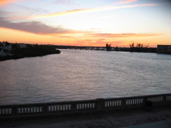
The
next intermediate goal is the tall bridge over the St. Lucie canal at Port
Mayaca, which I reach at 4:50pm.
It’s
a bit of a challenge to get up there, with the head wind on the approaching
road as well as 150 miles (240 km) in my legs by now. Once up on the bridge,
the view to all sides is very rewarding, however!

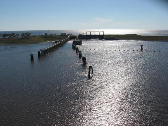

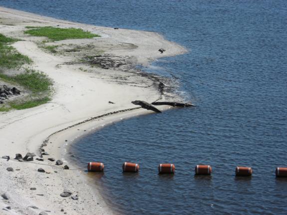
The
last picture shows some smoke in the distance (right side of skyline) which I
think could be from a forest fire. What I don’t know yet is that this fire will
cause a considerable amount of change to my plan!
I
depart from this high perch and get on the road East to connect with another
Hwy 710 near Indiantown. As soon as I reach Hwy 710, I learn that this road is
closed due to fire, and all traffic must re-route! That’s a tough blow for me,
as I am getting really tired by now and would like nothing more than a quick
direction back home. In the end, this causes me to re-trace 710 back a bit and
then continue East towards Hobe Sound considerably further North than

It’s
6:00pm and the sun is starting to get low. While this makes for very nice
evening mood right now, I also know that it means getting dark not soon thereafter
and I still have about 30 miles (50km) to go!
I
stop one more time at the turn-off of Hwy 708 to connect East with Hobe Sound
and I-95 / Turnpike.
I
remember this intersection vividly from a previous 200 km loop from Wellington
when I had run out of fluids due to lack of gasstations or shops along the way.
At 6:50pm I cross the Turnpike.

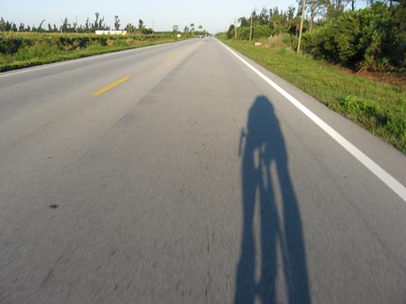
And
then I chase my own shadow heading straight East in the final kms for the 300km
mark in Hobe Sound.
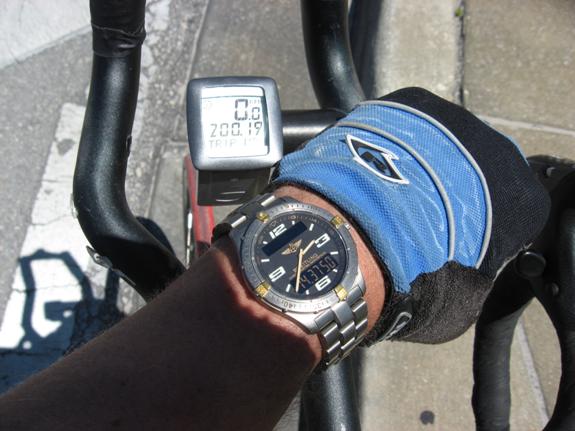
I
find myself letting the odometer dictate my speed, largely due to the fact that
I am closing in on 300km and want to stay under 10 hrs of ride time, i.e.
average speed of 30 km/h. I’m on pace for that, but strangely, at 299.42 km the
odometer stops working! This might be due to some interference with its
wireless connector, but in any event it’s very annoying! No amount of
mechanical fiddling will fix it, so I continue w/o odometer, only to find that
about 10 km later it starts working again. As I said, very frustrating.
The
low near-setting sun prompts me to stop and arrange for one more self-timed
picture with beautiful colors in the evening light.
The
next couple of miles I follow along US-1, with a few final hills caused by
sand-dunes adding to the challenge. A beautiful sunset greets me when passing
the bridge over the Jupiter Inlet.
The
last rays of light see me stopping in
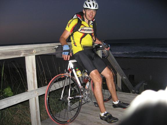
As
if timed exactly that way, Jill just parked her car coming back from a long day
at work when I pull into our community at 8:30pm, 14 hrs after starting the
ride in Clermont some 325 km (203 miles) away. Anything I can do for you? Sure,
how about taking the last picture!
Adventure
can happen everyday if you imagine it; it is up to yourself to make it happen!