Hiking in the High Sierra
It’s
a week prior to Labor Day weekend 2005. South Florida had just escaped a major
blow from hurricane Katrina (unfortunately
I
realize that I still have an award ticket with Northwest Airlines from the tens
of thousands of miles airtravel over the last 3 years. Better redeem that trip
now before NWA is going bankrupt! I quickly check for connections and find a
sequence of flights from
Saturday, September
3rd, 2005
Tannaz
and the kids will spend their Labor Day weekend in

I
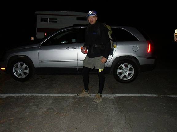
have my big backpack and my Notebook case, plus my heavy hiking boots (even though
it turns out that I won’t need or use those at all). The flights are smooth and
on time. We arrive at LAX airport around 1:30pm local time. That gives me
another couple of hours to get the rental car and drive up North towards the
As
there are no more cars in the midsize category at Enterprise Rental Cars, they
offer me a free upgrade to a Chrysler Pacifica – not bad at $22/day! I throw my
gear in the car and hop on the 405
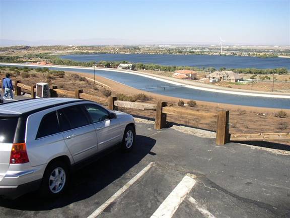
Water
management is everything here in dry

It
always amazes me how in this day and age we can just hop on a plane to fly
across the entire continent some 3000 miles and then drive a car some
additional 200 miles through the desert to get to the High Sierra from South
Florida within a few hours! Just a few decades ago without jet travel this
approach trip would have been a big undertaking of several days, if not weeks!
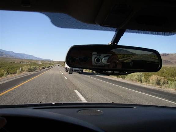
Time
is passed with a few snacks and sips from a water bottle while watching the
occasional truck and looking at the unfolding scenery. I’m also getting used to
the handling of the
The
drive takes about 3.5 hrs. At the Southern entrance of the

I
stop at the local Ranger Station to obtain a wilderness permit for the next two
days and enquire about the weather conditions. Well, no big surprise here, as
the Yahoo weather page a few days ago already showed a cloud-less sky for the
next 10 days! In fact, I would not see a single cloud until on the return
flight on Tuesday several hundred miles to the East – major portions of the
entire Western continent are under a high pressure system without any clouds.
Originally
I had thought about continuing further North to
Instead
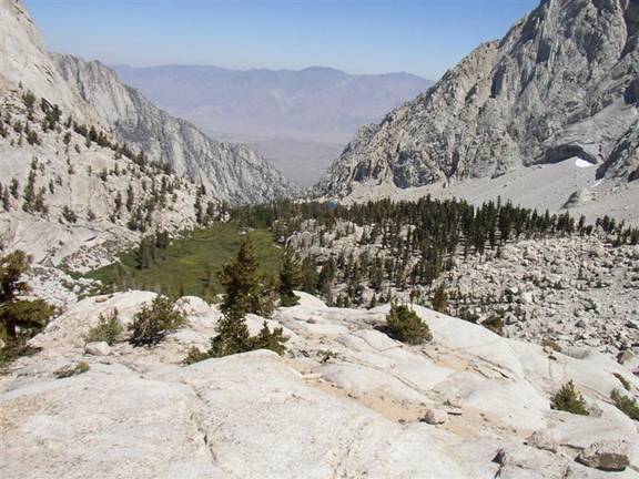
I drive up the local road leading up to Horseshoe Maedows for a scenic view of
the
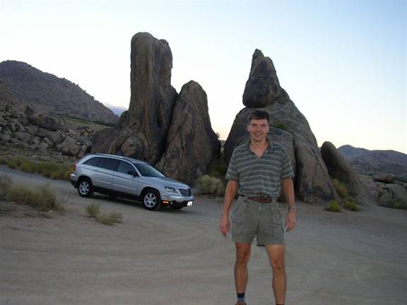
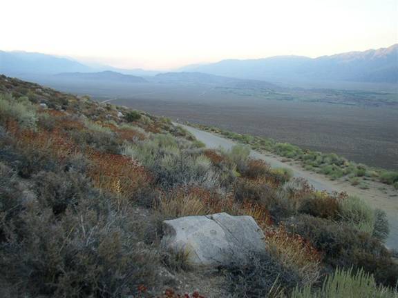
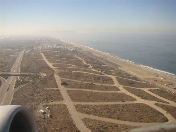
I
race the sunset to the top of the switch backs for some really scenic views
down the valley. I don’t get to the top, instead I stop half-way up for some
pictures. When I scramble up the embankment to get above the road I slip and
cake my camera with fine dust – not good. Lone Pine is visible at the right edge
of the picture below.
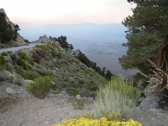
I
still drive up to the highest switch-back about 3000 ft above the valley floor.
Very close nearby is a hangglider take-off which got somewhat famous in the
80’s when they launched world-record setting long flights up North along the
Owens Valley and then into Nevada. I drive up there and step out fo the car,
looking down the take-off where the remnants of a wind-sock or two are flapping
in the eveing wind. I wonder what it must have felt back then for those pilots
at launch, their oxygen masks ready to use later during their flights at
elevations well above the High Sierra, often reaching 16.000 ft or higher!
A
few hours ago when I was approaching the temperature was well in the mid
nineties, now the air cools down rapidely in the higher elevation of perhaps
7000 ft. Soon the temperature drops below 60F - it hasn’t been this cool in
Before
it gets too cold and dark I drive down again and decide to stay overnight at a
Best Western motel in town. There will be plenty of time for my first day-hike
tomorrow. So I have time for a nice dinner at Seasons, one of the few local
restaurants. As usual, I already download and check the digital photos from the
approach trip. May the good times last for the next three days!

Sunday,
September 4th, 2005
The
morning daws crystal-clear. The High Sierra gets the first morning sun and
glows in an orange light which creates a stunning contrast that’s almost too
much to handle for the optics of my digital camera. This photo shows

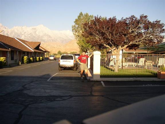
I
have some breakfast at the motel and chat with other hikers and guides. The
room I got in this motel certainly deserves the phrase “room with a view” as
you can see from this self-timed picture taken from the roof of my rental car
just outside the room.
Two
more things I need to do: One is shopping for the next two days and the other
is to rent a bear canister from the ranger station. While waiting for the
foodstore to open at 8:30am I dispatch an email via the wireless Internet of
the motel which I tap into while sitting in the car J
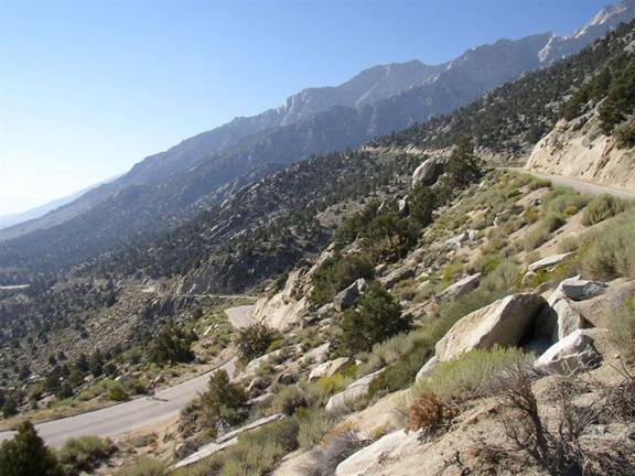
Then
I drive up the Portal road to the campground and trailhead. With the morning
sun the view is different from last night, but nevertheless quite spectacular.
At one switch-back I pause for a few pictures and watch two mountain bikers
slowly pedaling up the road rising above the haze of the valley.
Shortly
after the road turns back due West it arrives at the so-called Whitney Portal.
As if framed for that purpose, the summit of
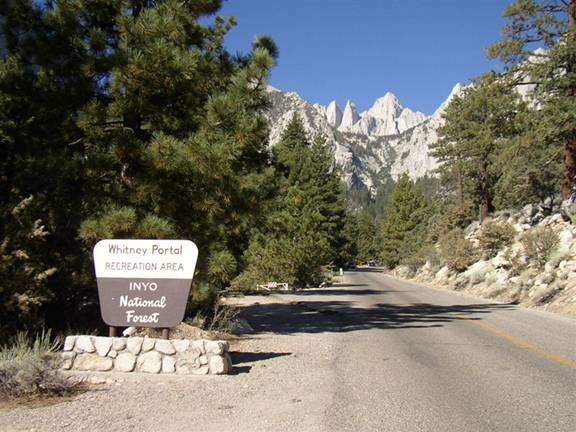
I
register with a local camp ground for one night stay and park my car at one of
the few remaining free spots. I stow all food in the special bear-resistant
metal boxes available at each site. Every visitor is well instructed not to
leave any food or other smelly items in the car – a photograph of a car with
broken side window is convincing proof that bears will find a way inside your
car if you leave food inside! Hikers also must carry a bear-proof food
container if they want to stay overnight in the back country. I won’t need that
as I plan to sleep in the car at the camp ground.
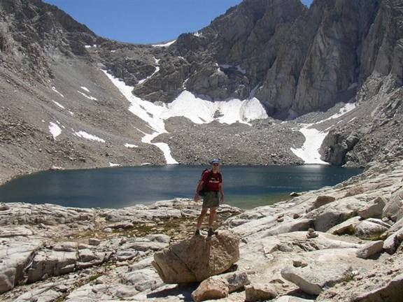
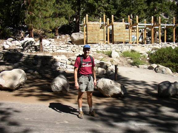
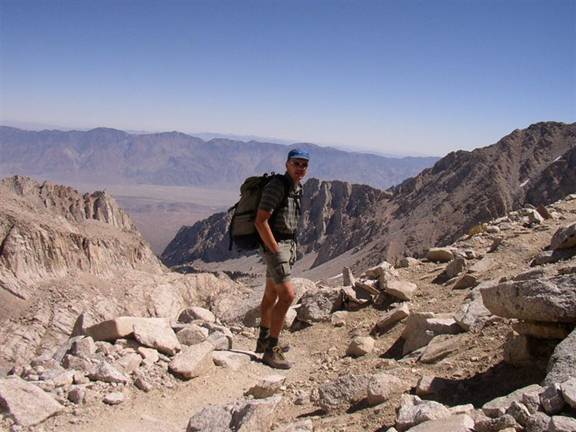
It
is 10:30am when I leave the trail-head for a day-hike up the
It
is hot and dry, plus with the high elevation one exhales a lot of moisture with
every breath. So it is important to drink lots of water to not dehydrate.
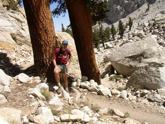
It
is a barren landscape up here, with some pine trees and a few meadows along the
creek beds punctuating the otherwise dry and rocky surrounding. The occasional
pine trees cast a welcome shadow along the path.
Obviously
there are plenty of other hikers around – after all, this is the best time of
the year for hiking the High Sierra, the weather is perfect and it is a 3-day
weekend due to Labor Day. But there is so much space up here that the foot
traffic is not a problem at all. In fact, I try to take advantage of other
hikers by asking them to take a picture here and there…
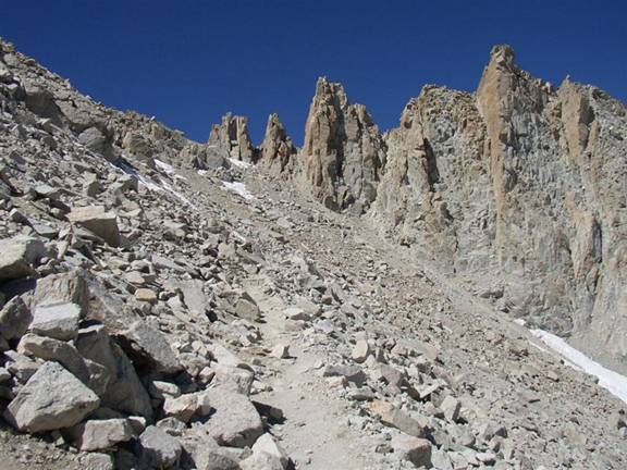
As
I continue to climb higher, the forest zone is cleared with the last trees
making a stand at around 11.000 ft. When looking back down I can see the valley
floor below as well as the mountain range to the East.
It
is up here that I experience the first effects of high altitude, with increased
heart rate and some shortage of breath, forcing me to go somewhat slower. At
this point I am not concerned, as I expected this to happen. About ½ hr later I
reach the
A
short time later I reach the second camp at 12.000 ft, my goal for the day. I
rest and chat with two guys from
The
walls towering above the camp are a playground for rock-climbers, albeit
somewhat remote and reserved for the well-acclimated! I walk around a bit,
scoping out the environment, getting water from a nearby spring and playing
with some rocks, taking advantage of some other hikers as photographers again.
After
spending perhaps 1 hr or so at this altitude I clearly feel its impact. I am
thinking that even with a much earlier start in the morning, continuing up
higher today would probably have been difficult due to the altitude. I am
hoping that tomorrow will be better, although I know that adaption to high
altitude does not work that fast…
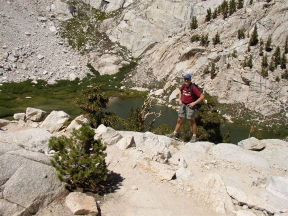
On
the way back down I rest at a grassy spot near
The
shadows of the High Sierra grow longer and create stark contrasts of light and
dark. The small Lone Pine lake sits as an improbable blue mirror spot amidst
the otherwise grey and green environment.

It
is another 3 miles or about 1 hr from Lone Pine lake down to the trail-head.
When I get there I first stop at the Portal store, a small convenience and
souvenir shop. They even serve food, and naturally I am hungry and eager to get
a good dinner prior to tomorrow’s ascent. Even though the store is open
8:00a-8:00p, their kitchen is only open until 6:30p. Unfortunately I get there
at 6:33pm, 3 minutes late, so they already clean the kitchen – too bad!
Nevertheless I buy some instant noodle soup and they also microwave a hot dog
for me. Thus I get at least some hot food. And because I am quite hungry I eat
a second round of soup and hot dog. Not exactly gourmet food, but then again
when you’re hungry enough everything tastes good! I chat with some locals who
summitted today – great stories all around.

I
am quite tired after the 6 hr round-trip hike, the intense sun, dry air, high
altitude and now the dinner. Also, the air cools off quickly as it gets dark
around 8:00p. I pull out my long bike pants as well as the fleece. This is the
most I will wear during the entire trip. When you are tired you feel the cold
more strongly – besides I’m really not used to cold air anymore …
There
is not much else for me to do other than to retire to my car. The backpack is
ready for an early start tomorrow morning – so all I do is creep into my
sleeping bag and try to get some sleep.
Monday,
September 5th, 2005
It
has been a night of tossing & turning. Even though the back seats of the
Chrysler Pacifica fold down to create an almost flat surface, I continued to
slip to one of the corners and tried unsuccessfully to find a real comfortable
position to sleep. Every half hour or so I wake up to rearrange and find
another position. At least I was not cold and the wind largely stayed outside
except for the windows open just an inch or so to let some fresh air inside.
The
alarm rings at 4:45am. There is no moon but the stars shine so bright that you
can see them clearly even through the black-tainted windows. I am practically
ready to go as soon as I get out of my sleeping bag. I just get most of my food
from the nearby bear-resitant food-box, drive up another mile or so to the end
of the road, park the car and get ready to leave.
A
few hikers have left before me and are seen walking higher up with their
respective head-lamps blinking through the light forest. I try to get into a
good rhythm, taking it extra slow this morning due to the long ascent and high
elevation awaiting me today. As soon as I get a bit higher the morning starts
to dawn. It is exceptionally clear in the air this high, and there is a
stunning display of colors, ranging from black to light blue and a touch of
yellow, with the street lights of Lone Pine glowing in the dark valley below.
While you get a glimpse of that mood from the picture below, it isn’t even
close to the real thing! Our eyes adapt to the light conditions and have an
infinitely better resolution than the 3 MegaPixel chip in my digital camera.
Plus the sounds of rushing water and the smells of the pine forest all around
all make for what cinematologists would call an “immersive experience”.

As
always, I’m thinking what a great adventure when you start in the predawn hours
of the day! 45 minutes later the morning sun paints warm, yellow colors on the
surrounding rock faces.

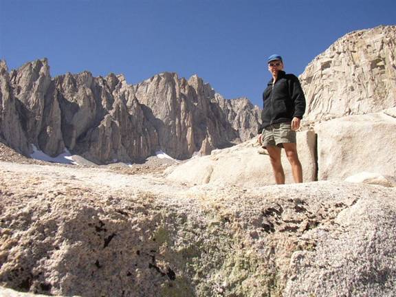
I
feel confident about the day, with an early start, plenty of daylight (13 hrs)
and after the reconnaiscence day-hike yesterday. Again, there are plenty of
other hikers up here, many of which can be seen packing up their tents as in
this picture on the rock plateau below.

It
is only 8:30am when I reach the level of

Just
before 9:00am I reach the spot where I had turned around yesterday. I had
deposited a half-full bottle of gatorade, thinking that I wouldn’t have to carry
it up today. Unfortunately it is gone! Probably not the bears, but hungry or rather
thirsty campers! Anyway, there is a spring with fresh water nearby, so not to
worry.
As
I continue to climb higher the two lakes become visible. The trail reaches the first
patches of snow. It is so dry up here that even at this elevation around 13.000
ft (4000 m) there is hardly any snow, much less any glaciers worth mentioning.
The trail cuts through some moderately steep slabs of granite polished smooth
by millenia of glacial activity, but that must have been a very long time ago.

It
is brutally hot in the sun, but with a cold wind blowing down, so it alternates
between uncomfortably hot and chillingly cold. In the shade the water on the
trail is frozen ice so one has to occasionally watch the step.
Now
I really start feeling the impact of the high altitude. Even though I walk very
slowly on the gently sloped trail I am short of breath. I feel the onset of a
severe head-ache. I rest frequently, but can’t really recover any strength. Suddenly
the thought occurs to me that the summit – even though not much more than 1000
vertical ft above my current position - might well be beyond my reach today!
There
is a long steep slope up to the saddle over which the trail crests to the West
side of the ridge above. I am thinking I will just take it easy and slow and go
up to the saddle for some nice views and pictures and see how it goes from
there. If only I could get up to the saddle I would rest and enjoy the view
towards the West.
Even
though many others are also walking slowly, I seem to be the slowest of all,
which is somewhat unusual L I also notice another strange thing: My heart-rate
is low, only around 100-110 bpm, much lower than I would have expected. When
climbing strongly my heart-rate would usually be around 120-140, perhaps going
up to 160 bpm. I would have expected the shortage of oxygen in the muscles to
be compensated by increased heart rate. But the muscles are not my problem
today…
Rather
suddenly there is also this bad feeling in my stomach which is rather unusual.
I stop and sit down, but things aren’t getting better. In fact, shortly
thereafter, my stomach is revolting and in several strong bouts I vomit all
over the trail! The red gatorade and the undigested cereal bar come up. That is
bad! This has NEVER happened to me in the mountains, even though I have been
considerably higher than this, both in the French Alps on
I
am understandbly alarmed about my condition. However I feel better after this
episode and slowly continue a bit further – if only for a few minutes. I reach
a
The
ridge to the East of the
But
not for me today: I know that the ONLY remedy against altitude sickness is to
get down to lower elevations, and get down fast – no rest or anything else will
help. I still have vivid memories of my good child hood friend Kurt
experiencing similar sickness and vomiting near the top of the Grossvenediger
some 20 years ago. Apparently the body reacts to the shortage of oxygen with
getting rid of anything in the stomach which might divert blood and oxygen away
from the other vital organs and the brain. Back then Kurt pressed on and lived
through an ordeal of complete exhaustion and misery all the way down. And he
was lucky in many ways, partly because he could ski down without much effort
which quickly brought him back to lower elevations.
Here
I am already 1000 ft (300m) higher than the Grossvenediger summit and there is
no quick skiing down to lower elevations. Suddenly it dawns on me that if I
want to get down under my own power I have to turn around immediately. So
without any further delay I start heading down. The dream of a summit view
today from
While
this certainly hurts and dampens my spirit somewhat the important task at hand
is to get down fast. A strong head-ache and fatigue sets in. I feel like in a
race against time: If I stop and rest now, further deterioration due to the
lack of oxygen will set in. So I will myself to continue, carefully watching my
step so as to not trip or lose my already somewhat impared sense of balance.
Every step down will bring ever so slight relief and denser air to breathe. Not
far below
The
irony of this situation is that Kurt summitted Mt. Whitney also nearly 20 years
ago after flying in to LAX, driving up the same day and hiking all the way the
very next day without any acclimatization. Of course, he was 20 years younger
than we are now, and perhaps living in
It
amazes me again and again how quickly conditions can change in the high
mountains and how much your perception gets funneled around only how to bring
relief for basic necessities – whether it’s relief from cold, thirst, hunger,
or in this case, hypoxia. All the splendid surroundings, the view and all –
it’s all irrelevant to me now. All I care about is to get down and find some
rest as soon as I’m further down. I do so at the first meadows along the trail
which is at about 11.500 ft.

I
lay down on a soft cushion of grass next to a small creek of running water. It
is like an oven without much wind and a relentlessly hot sun. After some 15
minutes I have to turn around so as to not get roasted on the side exposed to
the sun – despite the frequently applied SPF 30 sunscreen.
All
perception is like in a haze due to my oxygen-depleted state of mind. Quite
amazing how much the O2 level of your brain determines your well-being
and the perception of everything else around. It’s also well known that your
brain, while perhaps at 2% of your body weight, consumes upwards of 20% of your
body’s oxygen.
After
½ hour or so I feel rested enough to continue on down. Slowly at first, but
then noticeably I recover. Below Lone Pine lake at about 9.000 ft the whole
experience of misery is over almost as quickly as it set in. I also knew from
literature that symptoms of altitude sickness recede as soon as you get down to
lower elevations. It’s as if my brain and body switch back to normal mode now
that oxygen is delivered again in sufficient quantities…
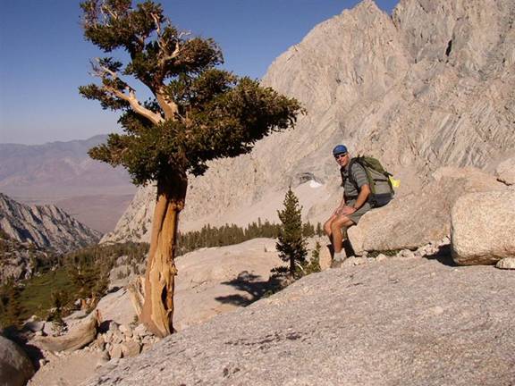
Of
course mother nature is as stunning as every other day up here. I try to stop
for a few shots, even though I admit that photography is not high on the
priority list when you’re not feeling well. At one point I notice a barren tree
I wanted to take a picture of the other day, but I’m already a few steps below.
Should I go back? Well yes, I can’t be that tired. But it costs me an extra
effort just to walk back up a few steps…

And
then I decide to stop at

It
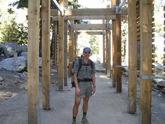
takes another hour or so to descend to the trail head. When I step through the
wooden structure which marks the beginning of the trail it is almost exactly 11
hours after I started in the pre-dawn hours. I am relieved that the descent is
over and that my head-ache is gone.
But
I’m also sad to have failed in the bid for the summit, after the flight across
the continent and the drive across the desert, after the two hikes up the
valley and then being stopped forcefully just short of the surround view from
the saddle or the summit. I will have to come back another time for that one!
I
retrieve some more food from the bear-resitant storage and start the drive back
down. At the top of the switch-back I stop, drink some gatorade, eat some nuts
and take in the view.

I
drive down, return the bear-proof canister at the ranger station and refuel the
car. With gas prices well above $3/gallon the fuel cost for this car-trip is
about as expensive as the rental fee of $71 after tax. When I got to the

The
drive back to
As
I get closer to
Tuesday,
September 6th, 2005
The
alarm rings at 5:30am so that I don’t get into

I
start writing this trip report and actually have free wireless Internet access
courtesy to a free service of the Canada Air VIP launch J Soon the flight is boarding and I need to pack
away my stuff. We take off on time over the sandy beaches of the Pacific Ocean
– no wonder they call this
The
flight continues West for a few minutes and I start to wonder why we are
heading out over the
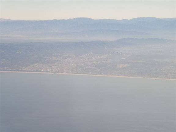
The
view is great from this vantage point. One can see the entire
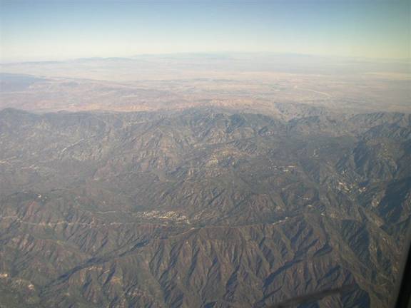
Again,
the digital picture pales compared to the real thing. For a long time I am
practically glued to the window, searching out familiar land-marks below in the
sky cloudless for several hundred miles. We also fly straight over
We
are approaching Minneapolis around 2:00pm local time, then continuing on over
Lake Michigan on to Detroit and finally fly back at night down to Fort
Lauderdale. The flight path is certainly somewhat of a detour, but such are the
idiosyncracies of award travel. The flight touches both the Mexican border
between
Some
7000 miles of flight, 600 miles of driving, all for 48 hours of hiking in the
High Sierra! It’s the sum of all these impressions, the sunrises and sunsets,
the high and dry air, the smells and sounds of mother nature, all of this combined
makes a trip like this so unforgettable. To be sure: A panorama photo shot from
the highest point of the lower 48 on a clear day like this Labor Day would have
been a coveted element in my collection! But as Ed Viesturs says: Getting to
the summit is optional, getting back down safely is mandatory. Ed knows for
sure, as he recently (May 2005) became the first American alpinist to do so on
all fourteen 8000m peaks. Another amazing thought of the power and importance
of acclimatization: I got altitude sickness at an elevation more than 3000 ft lower than Everest base camp (16.000 ft)
where people go back down to recover during their expeditions!
The
one question I mull over most on the long flights back home is this: When will
I come back with enough time to acclimatize and then make it all the way to the
top of