Bicycle Ride over the “Großglockner
Hochalpenstraße”,
the highest mountain pass in the Austrian Alps
I had long wanted to do a
bicycle loop in the Austrian Alps crossing the Großglockner pass –
Friday, July 23,
2004
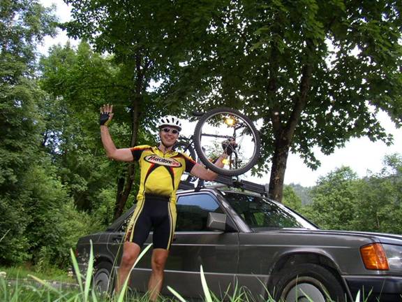
The
alarm clock rings at 4:40am. I load the mountain bike on my mom’s car and leave
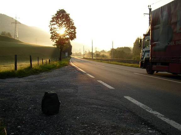
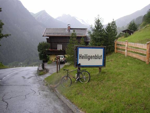
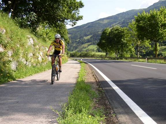
After
10km I reach the
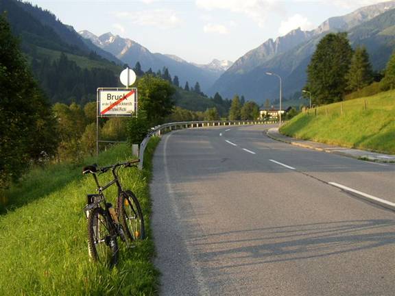
Another
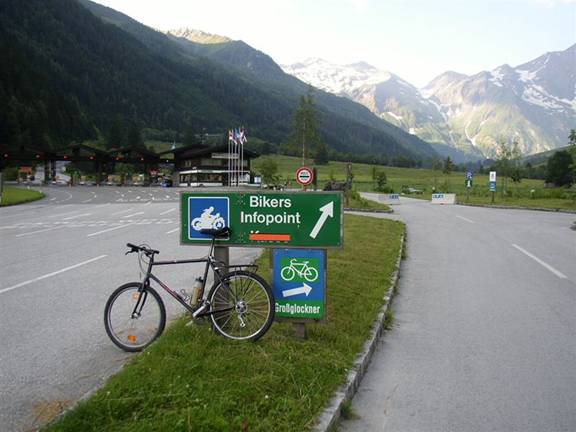
interesting point some 200m further up is the toll station in Ferleiten at the
base of the steep 12% graded climb. This is also a point where lots of bikers
start their trip. They even have a little booth where you can get a ticket,
ride up and then punch a clock on the top to see your speed going up the pass.
It
is 2 years since I have climbed a long pass with the bike. Living and riding in
I
am riding for 2:45 hrs now and I need some breakfast soon. The last 300m up to
the pass are quite strenuous and I am going really slow. It dawns on me just
how hard the racing must be in the Tour de France, where they go over multiple
passes like this in racing speed for 5-6 hrs a day – incredible! Finally around
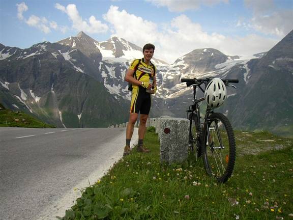
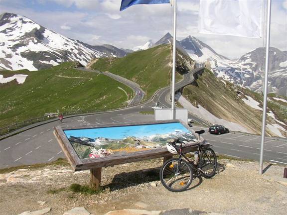
9:15am I reach the first pass called Fuscher Törl at 2400m. A nice view greets
the tourists who come up here in cars or tour buses. The actual Großglockner
mountain –
I
have some coffee and two portions of apple strudel for breakfast. Luckily there
are not many cars yet so the road is not too busy and you don’t inhale too much
exhaust and diesel on the ride up. However, there are plenty of bike riders
coming up here. I sit down with three other local riders who also have
breakfast and beer to celebrate their accomplishment of having come up here
under their own power on the bicycle. It is quite comfortable sitting in the
restaurant, having breakfast and chatting with the locals. I spend about 45
mins here, which will cost me a dry ride down the mountain, but I don’t know
that yet. I continue around 10:00am first going down the road to the ‘Fuscher
Lacke’ about 250m down from the pass. On the dry road it is fun to rush down at
top speeds of maybe 70km/h. Soon however there is another short climb up to the
highest point.
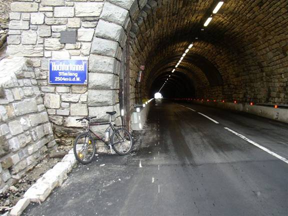
Now
the sky is darkening and black clouds are brewing. I am in my own race up to
the highest point at the Hochtor at 2504m. I can hear thunder and know that it
will start to rain any minute now. Eventually I reach the Hochtor where a short
tunnel cuts through the crest of the pass.
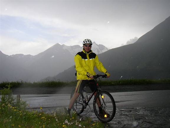
The
first drops of rain are falling and I put on my Gore-Tex jacket. As soon as I
exit the tunnel on the other side it is raining hard. Too bad, as the 1500m
descent is much less fun on the wet, slippery road. And it is also getting
quite cold, with my upper legs freezing cold due to the cooling effect of rain
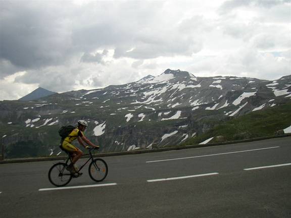
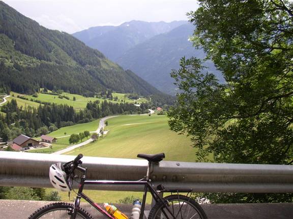
and high speeds of going down. I stop for one picture about half-way down the
pass.
The
Großglockner summit is visible just to the right of my helmet, as are the
raindrops which appear as white dots on the flash photograph. The wet descent
continues all the way to the
It
took less than ½ hour to get down here. I don’t waste any time and continue on
further South as I expect dry roads and sunshine ahead. My bike jersey and
pants are the first to dry off, but my shoes and socks are soaking wet and will
take longer to get dry again. Soon the weather turns real sunny again. Right
now it is much nicer down here below 1000m as compared to the 2500m alpine area
just ½ hour ago. I can see the mountain range of the Lienzer Dolomiten in the
distance and it feels quite different riding on the South side of the main
mountain range of the Alps – almost like in
It
is almost 12:00pm noon and I stop in Winklern to buy some drinks, fruit and
power bars as well as to have lunch at a restaurant. I spread out on their patio
to dry up shoes and socks. After 20mins or so it is getting so hot that I need
an umbrella. The temperature is around 30C (92F), so the next stretch of my
ride will be quite hot.
Upon
departing from the restaurant in Winklern I see a rider on a road bike zooming
past on the main road. I hurry to catch up to him, spinning madly in the
highest gear on my MTB. Luckily I reach him soon. Hence I get to draft behind
his wheel for the next 30km through the ‘Mölltal’ valley. He has also crossed
the Glockner pass and he is doing an even bigger 1-day loop than mine, leaving
in St. Johann and closing the loop further East crossing back over the
Katschberg pass.
It
is brutally hot, initially with a tailwind. It feels like in an oven. My shoes
get a blow-dryer treatment, and even though it was freezing cold on the descent
1 hr ago, I now sweat heavily and have trouble staying cool enough. I drink 1
liter of gatorade while drafting behind the other rider. We cover the 30km in
50 mins with a nice average speed of 36km/h (22.5mph).
From
the
Even
though it is much shorter and at low elevation, it is excruciatingly hot. With
temperatures above 30C and hardly any wind or shade it is just brutal. The
clock is ticking and I don’t want to miss the train at 2:40pm, which would cost
me at least another hour. I stop twice for short drink breaks in the shade.
Every 200m there is a mile marker which helps to count down the 8km distance. I
can easily see that a Tour de France rider can lose 10mins or more on just one
climb on a bad day. I am dehydrated and after more than 8 hrs and 2300 vertical
meters I am having serious trouble getting up this part of the road. Only the
clock keeps pushing me ahead. I stop at a monument where the National Park ‘
Thankfully
the road flattens now and within another km or so I reach the train station
with 10 mins to spare. I cool my head and arms with cold water and drink plenty
of fluids. Sitting in the air-conditioned train while going through the tunnel
is very refreshing.
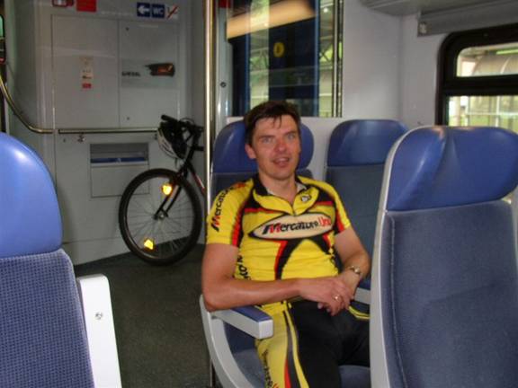
I
study the map and eat apples and chocolate bars. Less than 15 mins later I am
on the road again, now back on the North side of the Alps riding in the
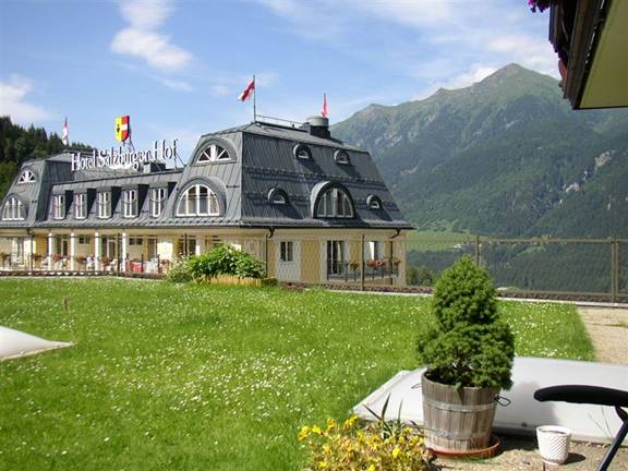
After
45mins of chatting and relaxing over coffee I continue on to complete the 160km
loop. It is around 4:30pm already. Luckily the wind had turned to South so I
can cruise out the valley with a slight tailwind on a nice bike path hugging the
main road.
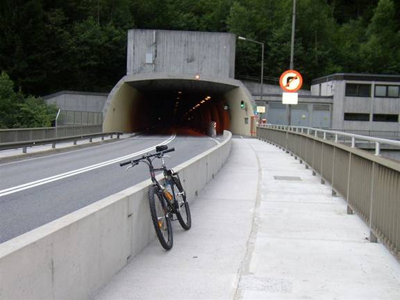
The
last obstacle is a 4km long tunnel which I am concerned about due to the bad
air quality inside. However, it is sloped downwards going North, so you can
ride along at good speeds without much effort. They also have a bike path
seperated from the main road through a fence, so the passing is quite safe.
From
the North end of the tunnel near the village of ‘Lend’ it is only about 10km
back to Taxenbach where I parked the car. The road is still going downhill
which further helps me close the loop. Almost 12 hours after I left this place
I return to the car in Taxenbach.
The
1 hr drive back to
Finally
I had closed this loop over the Großglockner. The day had brought so many
different weather conditions, from crisp early morning mood to thunder, rain
and cold on the mountain pass to sweltering heat and sun in the valley in the
afternoon. Also there were plenty of different areas to be passed and the ‘